Crest of the Blue Ridge Highway
The Parkway before the Parkway
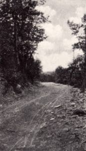
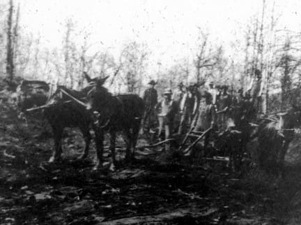
A portion of the Crest of the Blue Ridge Highway near Altapass in 1914. Today this is the only section of the Blue Ridge Parkway that follows the original route of the Crest of the Blue Ridge Highway.
In the early 1900’s, Americans were gaining great mobility with the invention of the automobile. In 1906, North Carolina’s State Geological and Economic Director, Joseph Hyde Pratt, had a vision of bringing visitors to the North Carolina mountains to experience views “never to be forgotten”. Hyde proposed a scenic toll road along the crest of the Blue Ridge Mountains from Whitetop Mountain near Marion, Virginia to Tallulah Falls, Georgia. The Yonahlossee Road around Grandfather Mountain was already included in the route and surveying of the remainder of the 350-mile route began in 1910. Camps were set up along the survey route, including one near the Clinchfield Railroad between Altapass and Gillespie Gap. Most of the route lay in North Carolina. Work began on the road in July of 1912 by Pratt’s Appalachian Highway Company of Chapel Hill. World War 1 brought a halt to the construction of this first mountain parkway. Fortunately, in the 1930’s, a movement to create the Great Smoky Mountains and Shenandoah National Parks in the eastern United States resurrected the idea of a mountain parkway that would connect the two parks – the future Blue Ridge Parkway. One section of the Blue Ridge Parkway closely follows the “Crest of the Blue Ridge Highway” near Altapass between mile markers 317.6 to 318.